This started with an HTML map made for personal walks. It already had the part that takes time to put together. Each entry had a name, a pin and a short note about why each place was worth a look. We kept that collection and gave it a memory.
Project write-up · 18 November 2026
Choosing a stop in South Brisbane.
Open To visit and look around the river. Fish Lane, South Brisbane Railway Station and the old dry dock are all pins you can open. Selecting Fish Lane brings up its area, a description and a note about the pin’s accuracy. The list gives you another way to pick a landmark when several pins overlap.
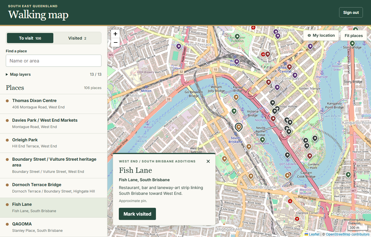
On a phone, My location centres the map when you ask. Your position stays in browser memory. You decide when you’ve visited a place, which also works for an outing you want to mark off later from your computer.
Crossing a place off, and putting it back.
Choose Mark visited. Once the server confirms the save, the pin and its list entry disappear from To visit. Switch to Visited to find it again. If you tapped the wrong landmark, open the entry and choose Mark unvisited.
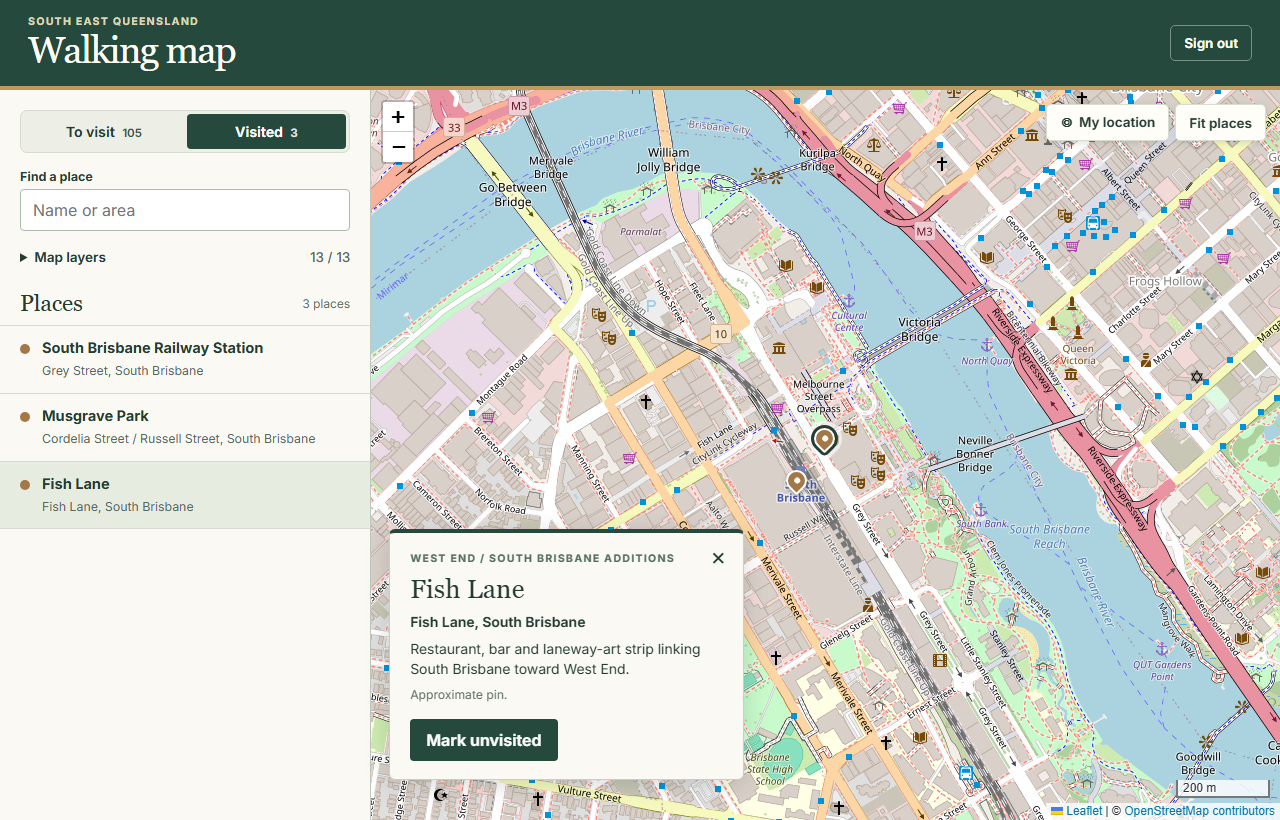
If reception drops while saving, the place stays visible with a retry action. Sending the same check-off twice is safe. When you next open the map on another device, the same login brings up your saved list.
Give each landmark a permanent ID.
Leaflet draws the map. PHP serves the private catalogue after sign-in, and SQLite keeps the set of visited place IDs. Two landmarks can share coordinates and still be checked off separately. Correcting a description or moving a pin also leaves earlier check-offs intact.
CREATE TABLE visits (place_id TEXT PRIMARY KEY);

INSERT INTO visits (place_id) VALUES (?)
ON CONFLICT (place_id) DO NOTHING;

DELETE FROM visits WHERE place_id = ?;
The question marks are bound parameters. The server checks the submitted ID against its catalogue and requires a signed-in session and a form token. The browser changes its list after the write succeeds. A single filtered collection supplies both the sidebar and the map markers.
For a similar project, the Leaflet reference covers markers and layers, and the PDO SQLite manual covers database access. Keep map attribution visible and follow the OpenStreetMap tile usage policy.
A brief you can give your LLM.
Start with a small collection of places you already want to visit. Give each place a stable ID before adding the first check-off.
Build a private walking map for one person using Leaflet, PHP and SQLite.
Import public destinations with stable IDs, names, groups, coordinates, descriptions and pin-accuracy notes. Keep the catalogue and visit database outside the public directory.
Show the same filtered places in a map and a keyboard-accessible list. Include To visit and Visited views. Provide an explicit action to restore a place.
Save visit status by ID after checking the login, request origin and CSRF token. Make repeating a save safe. On network failure keep the current view and offer Retry.
Request location only when the user taps My location. Keep that position in memory. Use attributed OpenStreetMap tiles for the current view.
Test on a phone and a computer. Check two places sharing a pin location, a repeated save, a failed save, restoring a place, and opening the same list on another device.